



Is an East Shore or Emerald Bay Boat Tour Better in Tahoe?
Deciding between cruising the serene granite boulder gardens of the Nevada coastline or entering the historic glacial fjord of the West Shore is a common dilemma for travelers. Choosing an East Shore Lake Tahoe Boat Tour delivers access to turquoise shallow waters, massive granite rock fields, and secluded sandy beaches like Sand Harbor. Conversely, choosing an Emerald Bay Boat Tour showcases dramatic cliff walls, the lake’s only island, and historic Scandinavian architecture. Comparing geological features, water conditions, and navigation factors helps you pick the right coastal route for your day on the water.
Table of Contents
ToggleWhat Makes the East Shore Coastline Unique?
The eastern perimeter of the lake, stretching from Crystal Bay down toward Cave Rock, offers some of the most striking geology in the Sierra Nevada. Millions of years of glacial carving and granite erosion created massive, rounded granite boulders that dot the shallow shoreline.
Floating over these rock gardens reveals vibrant hues of light teal and aquamarine. White quartz sand fills the gaps between boulders, reflecting midday sunlight back up through the clear water column.
- Sand Harbor State Park: Famous for broad sandy beaches, protected swimming coves, and massive underwater rock labyrinths.
- Secret Cove and Chimney Beach: Quiet, uncrowded shoreline spots surrounded by steep pine forests and granite cliffs.
- Thunderbird Lodge Estate: Historic stone architecture built right onto the rocky cliffside, surrounded by clear deep water.
- Skunk Harbor: A protected historical cove offering quiet anchorages away from main vessel traffic channels.
To learn more about setting up an East Shore cruise from our North Shore docks, visit us to browse available boat options.
Why Is Emerald Bay an Iconic Boating Destination?
Emerald Bay sits on the southwestern shore, recognized nationwide as a National Natural Landmark. This narrow, three-mile-long fjord was carved by ancient glaciers cutting through granite mountains thousands of years ago.
Approaching the mouth of Emerald Bay reveals steep, dramatic cliff walls soaring hundreds of feet above the water level. The bay drops into vivid emerald-green water caused by shallow glacial sills mixing with clear runoff from Eagle Falls.
Inside the bay sits Fannette Island, the only island found anywhere in Lake Tahoe. Perched atop this rocky island is the stone Tea House, built in the late 1920s by Lora Knight. At the head of the bay rests Vikingsholm, a 38-room mansion displaying authentic Scandinavian architecture. Approaching these historic sites from the water offers photos impossible to take from highway lookouts. You can explore our dedicated Water Sports Equipment Rental Services page to see all gear packages available for your coastal exploration.
How Do Coastal Geography and Wind Patterns Differ?
Wind dynamics and water depth vary significantly between the East and West Shores. The Carson Mountain Range rises directly behind the East Shore, shielding its shallow coves from early morning easterly breezes. This protection leaves the water near Sand Harbor smooth as glass during morning hours, perfect for underwater photography and paddleboarding.
Emerald Bay, located on the West Shore, experiences different wind patterns. The narrow opening at Eagle Point restricts large lake swells from entering the bay, keeping internal bay waters relatively calm even when open lake water becomes choppy.
However, navigating through the mouth of Emerald Bay requires extra caution. Shallow rock ledges near Eagle Point restrict vessel passage to a designated deep-water channel. Captains must maintain low speeds, monitor depth finders continuously, and yield to incoming vessel traffic moving through the narrow entrance.
What Are the Best Routes for Swimming and Photography?
Choosing between Emerald Bay Boat Tour or that of East Shore often comes down to what activities your group prioritizes during your time on the water.
- Best for Swimming and Floating: The East Shore wins for calm, shallow swimming spots. Sandy bottoms near Sand Harbor allow safe anchoring in eight to twelve feet of water, where water warms up faster than open lake depths.
- Best for Panoramic Photography: Emerald Bay offers dramatic mountain backdrops, waterfall views, and historical architecture within a compact area.
- Best for Avoiding Crowds: The hidden coves along the East Shore provide quiet pockets where your group can anchor far away from commercial tour traffic.
Read our guide on Sand Harbor Boat Rental options to learn how to plan a full-day East Shore cruise starting from North Shore harbors.
Why Choose North Tahoe Watersports for Coastal Tours?
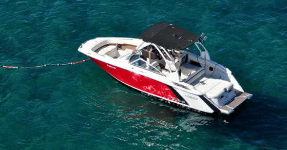
Whether you decide to explore the granite boulder coves of the Nevada shore or the historic waters of Emerald Bay, North Tahoe Watersports provides the ideal vessels and guidance. Our fleet includes smooth-riding tritoons and powerful bowriders equipped with modern depth meters, GPS navigation, and high-performance engines.
Our experienced staff helps you plan the best route based on real-time wind and weather conditions across the basin. If you have questions about fuel range, travel times, or custom pickup options, contact us to speak with our local dock managers.
Frequently Asked Questions
How long does it take to boat from Tahoe City to Emerald Bay?
Cruising at a steady speed of 20 to 25 miles per hour, the trip from Tahoe City along the West Shore to Emerald Bay takes roughly 35 to 45 minutes, depending on surface water chop and vessel traffic.
Can we land a rental boat on Fannette Island?
Landing motor vessels on Fannette Island is strictly prohibited by state park regulations to protect fragile ecosystems. However, captains can anchor nearby in safe water, allowing guests to swim over or paddle up to explore the stone structure.
Is the water warmer on the East Shore or inside Emerald Bay?
Shallow coves along the East Shore, like Sand Harbor, reach warmer water temperatures during mid-summer because shallow sandy bottoms absorb solar heat. Emerald Bay stays slightly cooler due to direct cold runoff coming down from Eagle Falls.
Are there public mooring buoys inside Emerald Bay?
State Parks maintains a limited number of public boat buoys near Vikingsholm on a first-come, first-served basis. If buoys are full, captains must drop anchor in designated sandy bottom areas outside marked swim zones and underwater cable lines.
What is the best departure time to avoid boat traffic near Sand Harbor?
Launching between 8:00 AM and 9:30 AM guarantees quiet water, easy docking, and clear anchor spots before afternoon boaters arrive. Early morning light also provides the best underwater visibility for photographing the famous granite boulder fields.